-

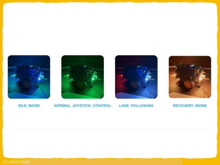
- Visual representation of the Duckiebot’s operational modes

-
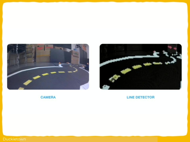
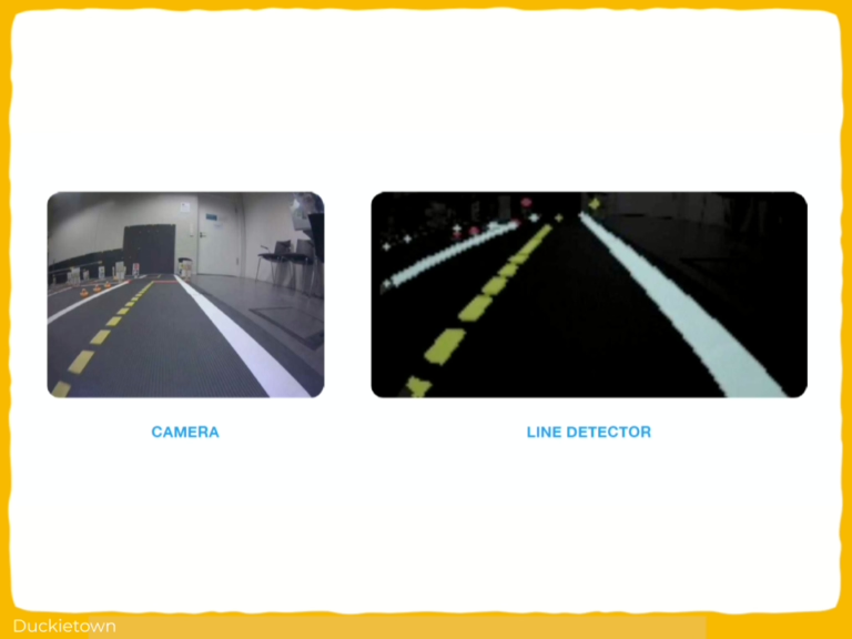
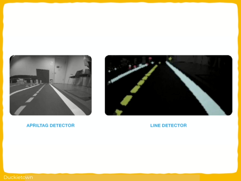
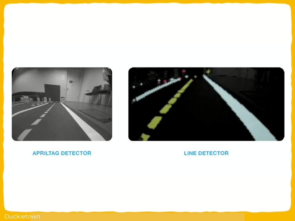
- Following the road using computer vision

-
- Detecting and stopping at the stop line

-
- Detecting intersections and executing turns
-
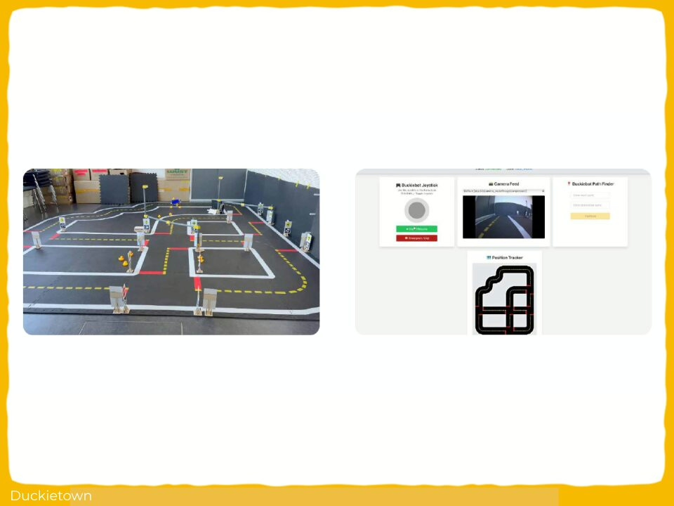
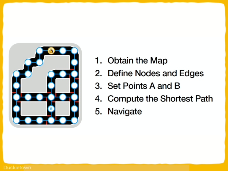
- Transforming Roads into a Navigable Network

-
- Navigation using Dijkstra’s Algorithm